PHYS/OCSC 2300 - Fall 2026 - Lecture 14
 Watch on YouTube →
Overview
The lecture connects Ekman transport to nutrient-rich equatorial and coastal upwelling, reviews Gulf Stream and Loop Current eddies, then tests geostrophic balance with a Gulf of Mexico example. Modeling a 300 km by 300 km by 1 m slab across a 30 cm sea-surface-height difference gives a net pressure force of 9 × 10^8 N and a geostrophic speed of 0.14 m/s, comparable to the roughly 0.30 m/s estimated from the circulation map.
Key takeaways
- East-to-west trade winds produce Ekman transport away from the equator in both hemispheres, driving nutrient-rich upwelling that appears as elevated chlorophyll in satellite imagery.
- Gulf Stream cold-core eddies rotate counterclockwise south of the current, while warm-core eddies rotate clockwise north of it; warm-core Loop Current eddies can intensify hurricanes.
- A 30 cm sea-surface-height difference corresponds to about 3,000 N/m² of pressure difference, using seawater density 1,025 kg/m³ and p = ρgh.
- For a 300 km by 300 km by 1 m slab, the pressure difference produces a net westward force of 9 × 10^8 N after the much larger atmospheric-pressure forces cancel.
- Balancing that pressure force with Coriolis force at 30°N yields a geostrophic speed of about 0.14 m/s, reasonably close to the roughly 0.30 m/s inferred from the circulation map.
- Geostrophic balance is a useful approximation for large, slowly moving ocean and atmospheric structures, but not for short-scale surface waves where gravity and other forces are important.
Chapters
- Assignment 3 has been posted with one week to complete it.
- The final assignment question concerns heat transport and temperature changes associated with El Niño, scheduled for the next class.
- The lecture plan is to finish the Atlantic discussion with geostrophic balance, then move to the Indian Ocean monsoon in a later class.
- Persistent wind produces Ekman transport to the right of the wind in the Northern Hemisphere and to the left in the Southern Hemisphere.
- East-to-west trade winds drive Ekman transport away from the equator on both sides, causing cold, nutrient-rich water to rise.
- Satellite ocean-chlorophyll imagery reveals productive bands along the Pacific and Atlantic equators, where nutrient-rich upwelling supports biological growth.
- Along California's west coast, north winds drive offshore Ekman transport; water drawn away from shore is replaced by cold, nutrient-rich water from below.
- The Antarctic Circumpolar Current flows west to east around Antarctica, while the East Wind Drift lies closer to the continent.
- The Gulf Stream bends away from North America's east coast and sheds eddies hundreds of kilometers across.
- Cold-core eddies form south of the Gulf Stream and rotate counterclockwise; warm-core eddies form north of it and rotate clockwise.
- The Loop Current in the Gulf of Mexico also produces warm- and cold-core eddies, and warm-core eddies can strengthen hurricanes passing over them.
- The SWOT satellite mission, Surface Water and Ocean Topography, enables higher-resolution observation of ocean and surface-water features.
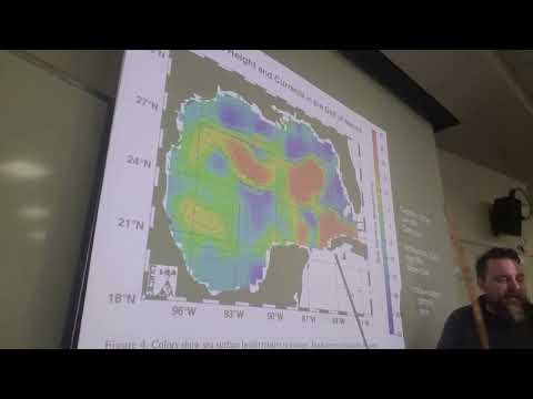
- In the eddy data map, red regions represent high sea-surface height, or gentle domes, while blue regions mark low sea-surface height, or bowls.
- A high sea-surface-height feature rotates clockwise and is anticyclonic; a low feature rotates counterclockwise and is cyclonic.
- Ocean sea-surface-height patterns and atmospheric pressure systems share geostrophic dynamics: pressure gradients and Coriolis forces balance in large-scale rotating fluids.
- The example compares a low sea-surface-height bowl near 92°W with a high dome near 86°W, separated by about 6° of longitude.
- At roughly 30°N, 1° of longitude is approximately 100 km, making the bowl-to-dome distance about 600 km.
- The modeled slab between the features is approximately 300 km by 300 km in horizontal area and 1 m thick.
- Flow between the bowl and dome is northward; the pressure force points west, so Northern Hemisphere Coriolis force should point east.
- Hydrostatic pressure from a water column is calculated with p = ρgh, using seawater density 1,025 kg/m³ and gravity 9.8 m/s².
- A 30 cm water-height difference produces approximately 3,000 N/m² of pressure difference.
- The western side has atmospheric pressure of about 1 × 10^5 N/m²; the eastern side has that same atmospheric pressure plus the 3,000 N/m² water contribution.
- The shared atmospheric-pressure contribution cancels when comparing the two sides, leaving the much smaller pressure difference caused by the dome and bowl.
- Each slab side wall has area 300 km × 1 m, or 3 × 10^5 m².
- The atmospheric pressure on either side contributes a force of 3 × 10^10 N, with opposite directions on the two faces.
- The additional 3,000 N/m² on the high-pressure side contributes 9 × 10^8 N toward the west.
- After cancellation of the atmospheric-pressure forces, the net pressure force is 9 × 10^8 N westward.
- Geostrophic balance requires the Coriolis force to oppose the net pressure force, so the required Coriolis force is 9 × 10^8 N eastward.
- The Coriolis-force magnitude is calculated as 2mΩ sin(θ)V, with θ = 30°N and Earth's rotation rate Ω = 7.27 × 10^-5 rad/s.
- For seawater density 1,025 kg/m³ and the modeled slab volume, the water mass is approximately 9 × 10^13 kg.
- Solving for V gives a geostrophic speed of approximately 0.14 m/s, or 14 cm/s.
- The circulation-map arrows suggest a speed of roughly 30 cm/s between the low and high sea-surface-height features.
- The hand estimate of 14 cm/s is within about a factor of two of the map-based estimate, supporting geostrophic balance.
- Pressure and Coriolis forces tend to balance in large, slowly moving ocean and atmospheric systems spanning hundreds of kilometers.
- Small, rapidly changing surface waves are different: gravity and possibly surface tension matter, and geostrophic balance does not apply.
Transcript excerpt
0:01 Okay, welcome back everybody. Um, we're on lecture 14 now. Uh, so um, in terms of uh, bookkeeping So, there's a there's a school bag up in the front. Is that Is this belong to anybody? Maybe it was just left here. Did anyone leave a bag up front? No, probably just left here. Um, >> [clears throat] >> Um, so I just want to mention bookkeeping wise, uh, the third assignment has now been posted. I posted it this morning. So, you have a week to work on that. Um, I think all of the material that you need to work on the questions um, has now been covered with the exception of El Niño. So, the last question um, is about uh, the sort of heat transport and the temperature changes that are associated with the El Niño. Uh, we should get to El Niño on Wednesday. So, after
0:48 Wednesday, uh, you should have everything you need uh, to do the third assignment. Um, Uh, any questions? Logistics, anything like that? Okay, great. All right. So, um, So, we have been starting um, on our our tour uh, of the uh, different ocean basins. And last time we talked about uh, the Southern Ocean and also the Atlantic Ocean. Uh, but before we get into that, um, we talked about this cornerstone um, of uh, physical oceanography, which is all all the Ekman idea. So, it's called the collectively it's called Ekman dynamics, but basically the idea is um, that when wind uh, blows over the surface of the ocean persistently over long periods of time um, because of the effect of the
1:34 Coriolis force, uh, the water doesn't move directly with the wind. And in fact, um, the overall movement of water um, uh, is called the Ekman transport and
This is the start of the transcript. Save this video free for the whole transcript, searchable and time-coded.
Related notes
Summary, takeaways, and chapters were generated by AI from the video's transcript and may contain errors. The video belongs to its creator, JoeFitzgeraldPhysics.