PHYS/OCSC 2300 - Fall 2026 - Lecture 10
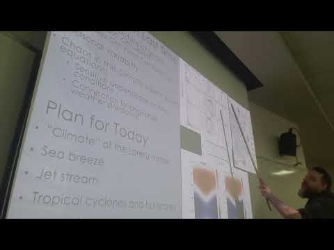 Watch on YouTube →
Overview
Joe Fitzgerald connects atmospheric circulation to weather and climate by explaining Lorenz chaos, sea and land breezes, the jet stream, and tropical cyclones. He shows how small initial-condition differences limit weather forecasts while the Lorenz system’s strange attractor constrains its long-term behavior, then explains hurricane energy, formation conditions, and steering by background winds such as the Bermuda High. The lecture also models expectations for the course video project: include at least two figures from the research paper and explain the science clearly, whether the presentation is conventional or creative.
Key takeaways
- Lorenz’s convection simulations show that nearly identical initial conditions can produce sharply different later states, which places a fundamental limit on detailed weather forecasts.
- The Lorenz strange attractor constrains long-term model behavior to a butterfly-shaped fractal surface with a dimension near 2.1, even though individual trajectories remain chaotic.
- Daytime sea breezes arise because land heats faster than ocean, while nighttime land breezes reverse direction because land cools faster than water.
- The jet stream flows between pressure zones with pressure-gradient and Coriolis forces approximately balanced, and its meanders and eddies make it dynamically variable.
- Hurricanes intensify when condensation releases latent heat stored by ocean evaporation; warm water supports this energy supply, while strong wind shear disrupts storm organization.
- Atlantic hurricanes are steered by background circulation: trade winds carry them west, and the Bermuda High can turn them northward, rather than Coriolis force acting alone.
Chapters
- Kobe Baker’s Thwaites Glacier presentation explains the grounding line, IceFin AUV observations, and melt rates of up to 30 meters per year along steep crevices.
- A creative news-style presentation covers underwater volcanic eruptions and tsunami generation, but Joe Fitzgerald recommends adding more technical detail and research-paper diagrams.
- The project must include at least two official figures or diagrams from the paper; other visuals may come from online sources, stock images, or AI generation.
- Earth’s rotation divides equator-to-pole circulation into Hadley, Ferrel, and polar cells, which counter-rotate like interlocking gears.
- The Hadley cell is strongest, the Ferrel cell is intermediate, and the polar cell is weakest; seasonal circulation is stronger than the annual mean.
- The Hadley-cell updraft shifts toward the warmer hemisphere, moving south during Northern Hemisphere winter and north during Northern Hemisphere summer.
- Long-term wind bands describe statistical climate patterns, while weather refers to local conditions on a particular day.
- Lorenz’s convection model represents air between a warm lower boundary and a colder upper boundary, producing rotating roll circulations.
- Simulations initialized with nearly identical states initially track one another, then diverge substantially, demonstrating sensitive dependence on initial conditions.
- This butterfly effect limits detailed weather prediction: tiny differences in observations can eventually produce different outcomes, such as whether a hurricane makes landfall.
- The lecture distinguishes unpredictable local weather from potentially more predictable large-scale climate patterns such as El Niño.
- Lorenz tracks three variables, circulation strength, temperature anomalies, and the vertical temperature gradient, as coordinates X, Y, and Z.
- A model trajectory traces a butterfly-shaped strange attractor instead of filling all possible three-dimensional states.
- The attractor has a fractal dimension between two and three, approximately 2.1, showing that chaotic behavior can still be constrained over long periods.
- The attractor’s shape is distinct from the butterfly effect, which refers to sensitivity to initial conditions.
- Water’s high heat capacity makes the ocean warm more slowly than land under sunlight, creating warmer, rising air over land during the day.
- Cooler air flows from ocean to land near the surface to replace rising air, producing a sea breeze and a return circulation aloft.
- At night, land cools faster than the ocean, so air rises over relatively warm water and a land breeze flows from land toward the sea.
- The same land-ocean heating contrast helps explain monsoons as a continental-scale analogue of sea breezes.
- The jet stream is part of the mid-latitude prevailing westerlies and flows from west to east around the pole.
- On the illustrated Canadian weather map, higher pressure lies on the equatorward side of the jet and lower pressure on the poleward side.
- The pressure-gradient force points from high to low pressure, while the Coriolis force points in the opposite direction for the eastward flow.
- These forces approximately balance in geostrophic flow; the jet stream also meanders and develops eddies rather than remaining a straight, steady band.
- A hurricane is a rotating low-pressure system with an eye at its center; Northern Hemisphere hurricanes rotate counterclockwise and Southern Hemisphere storms rotate in the opposite direction.
- Hurricanes draw energy from warm, moist air over the ocean: evaporation stores latent heat, which is released when water vapor condenses in rising air.
- Released latent heat warms the atmosphere and helps strengthen the storm, while inflowing surface winds bring in additional water vapor.
- This thermodynamic mechanism distinguishes tropical cyclones from ordinary mid-latitude extratropical cyclones.
- The lecture uses approximately 120 kilometers per hour as the wind-speed threshold for hurricane strength; weaker systems are classified as tropical storms or tropical depressions.
- The Saffir-Simpson scale ranks hurricanes from Category 1 to Category 5 by wind speed, with Category 5 reaching roughly 250 kilometers per hour.
- Higher categories generally bring greater structural damage and more intense storm surge.
- Storms reaching Newfoundland are often downgraded to tropical storms or depressions, though hurricanes can occasionally arrive.
- About 80 tropical storms form globally each year, typically over sea-surface temperatures warmer than approximately 25 degrees Celsius.
- The Coriolis effect helps organize storm rotation, so hurricanes rarely form at the equator, where the Coriolis force is very weak.
- Atmospheric disturbances can provide initial perturbations that develop by drawing energy from latent heat.
- Strong vertical wind shear tilts and disrupts a hurricane’s circulation, making storm organization and intensification less likely.
- Hurricanes generally move with the large-scale background winds, a process called steering flow, rather than being pushed along by the Coriolis force alone.
- Trade winds carry many Atlantic hurricanes westward from the tropics toward the Caribbean and Florida.
- The Bermuda High’s clockwise circulation can redirect storms northward along the eastern seaboard.
- Joe Fitzgerald cautions against the textbook explanation that Coriolis force alone bends westward-moving hurricanes north, because pressure forces also matter and balance Coriolis forces in geostrophic flow.
Transcript excerpt
0:01 Okay, welcome back everybody. Um, we are on lecture track. So we're getting into we're getting into the course. Um, so today we're going to finish off the atmospheric discussion of the atmospheric circulation. So we've been talking about these three cells and the wind bands and pressure systems and all that stuff. And so today we're going to we're going to finish that and and we may get time at the end to start the next set of topics which is about ocean currents and how we observe ocean currents. Um, but at the start I just wanted to show a couple of examples for the for the video project. So these are um, students who did the project a few years ago when I taught the course and gave their permission to to share for future students. And so these are
0:49 two examples where I think there was a they're very different approaches but they both sort of did a a very good job and one of them is sort of more normal format and one of them is more sort of creative and fun but both are very good. Um, so I'm just going to play those and you can see a look to take a look. Um, and I'll mention that these are um, uh, one of them is a first draft and one of them is the final draft after uh, after the feedback process took took place. Okay, so this is Kobe Baker. She took the course a few years ago um, and so she's talking about um, uh, collapse of of Antarctic glaciers. Okay, so I'm just going to go ahead and play
1:36 this. So so the first you know, eight minutes or so we got they're a couple minutes each. And so let's take a look
This is the start of the transcript. Save this video free for the whole transcript, searchable and time-coded.
Related notes
Summary, takeaways, and chapters were generated by AI from the video's transcript and may contain errors. The video belongs to its creator, JoeFitzgeraldPhysics.