The Indus Civilization: The Discovery That Changes Everything
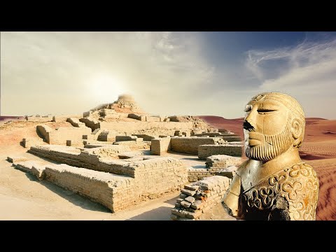 Watch on YouTube →
Overview
Show Me the World examines the Indus Valley Civilization through excavations at Harappa, Mohenjo-Daro, and especially Dholavira, revealing a 5,000-year-old culture of roughly 1,000 cities spread across a million square kilometers that mastered urban planning, sewage, and water management. The documentary highlights Professor R.S. Bishit's discovery of 16 rock-cut reservoirs holding 250,000 cubic meters of water around Dholavira, the rediscovery of the long-mythologized Ghagger-Hakra River, maritime trade routes reaching Mesopotamia via Bahrain and Umm an-Nar, and the still-undeciphered Indus script.
Key takeaways
- Dholavira was engineered as a water fortress: 16 rock-cut reservoirs holding 250,000 cubic meters surrounded a 48-hectare city, with a 13-meter elevation gradient enabling gravity-fed distribution between upper and lower districts.
- Mohenjo-Daro, home to 40,000 people 4,000 years ago, had citywide sewers, 80 public toilets, and private tiled bathrooms — sanitation infrastructure unmatched in the ancient world.
- The Ghagger-Hakra, long dismissed as folklore, was confirmed by satellite imagery and dried riverbeds; a tectonic event around 2000 BC shifted it east toward the Ganges, and 1990s wells revived the underlying aquifer.
- Professor R.S. Bishit's Dholavira evidence undermines the 'priest-king' model: the Indus polity was likely a multi-ruler economic and cultural network with several princelings rather than a single monarch.
- The 1999 Dholavira signboard — nine quartz-inlaid symbols over 30 cm tall, originally mounted on a wooden frame at the north gate — is considered the world's oldest signboard but remains undeciphered.
- Indus merchants ran a 3,500-km maritime trade network reaching Mesopotamia via Umm an-Nar and Bahrain, where carnelian ornaments and Indus pottery account for ~10% of finds in tombs dated 2300–2000 BC.
Chapters
- The 3,000-km Indus River fed a civilization that flourished for 500 years then vanished
- A century of digs has uncovered ~1,000 sites across 1 million square kilometers
- Early finds of toys, dice, and whistles led archeologists to mistakenly call them 'Arcadians of the Indus'
- Professor M.S. Vats excavated Harappa in 1920 while Adi Banerjee uncovered Mohenjo-Daro hundreds of km away
- European scholars initially reacted with incredulity, having downplayed early Asian civilizations
- The simultaneous finds reframed understanding of Bronze Age urban culture in South Asia
- City of 40,000 people on 1 square kilometer with grid streets at right angles, main avenues 9m wide
- 80 public toilets, private tiled bathrooms with wells, and citywide sewers with wastewater jars in cul-de-sacs
- The Great Bath sat on a raised brick platform above Indus floods, surrounded by a fountain gallery
- Trade hub in the Kutch marshes built with unfired brick walls, fired-brick foundations, and 15m monumental stone walls
- Masons used plumb lines and water levels; carpenters fit Himalayan cedar columns into polished stone
- Continuously excavated since 1989 from sediment 8 meters deep
- Professor R.S. Bishit identified the first rock-cut architecture by the Harappans, including a reservoir 85m wide
- Dholavira was ringed by 16 reservoirs holding 250,000 cubic meters of water
- The 48-hectare city of 20,000 people had a citadel, gardens, and granaries supported by the wheat and barley trade
- Stone dam remains in dry riverbeds show how Dholavirans diverted seasonal torrents into reservoirs up to 79m long and 7m deep
- A 13-meter elevation drop between upper and lower city allowed gravity-fed water transfer
- Aqueducts irrigated fields year-round and supplied the urban core
- A 4m-diameter, 20m-deep well in the citadel served ritual ablutions, its rim still grooved by water-skin ropes
- Two pools held water considered purest because drawn from deep earth
- Descending the steps symbolized contact with the Universal Mother and water's purifying power
- Satellite imagery and dried riverbeds confirmed the mythical Ghagger-Hakra once flowed through the Thar Desert
- A powerful earthquake ~4,000 years ago shifted the river eastward toward the Ganges basin
- From 1990, new wells tapped the surviving groundwater, repopulating abandoned villages
- Artisans worked carnelian, copper, bronze, ivory, and gold; jasper drills and standardized weights appeared in markets
- Over 2,000 steatite seals carved with zebu, buffalo, and crocodiles bear 400+ recurring signs still undeciphered
- In 1999 at Dholavira's north gate, a 30cm quartz-inlaid signboard was uncovered — possibly the world's oldest
- Bishit rejects the single 'priest-king' theory, arguing for a multi-ruler economic and cultural empire
- Caravans reached Balochistan and Afghanistan for copper, tin, silver, and lapis lazuli
- Ships sailed 3,500 km via the Strait of Hormuz to Mesopotamia, with goods found at Umm an-Nar and Bahrain
- Indus references vanish from Mesopotamian tablets after 1800 BC; theories include invasion, floods, earthquakes, and the Ghagger-Hakra's loss
- Dr. Alsendi's team searches Bahrain's 1,000+ burial mounds for a bilingual inscription to decipher the Indus script
- Water rituals at the 16th-century Adalaj stepwell and the Ganges preserve traditions traceable to the Indus people
Summary, takeaways, and chapters were generated by AI from the video's transcript and may contain errors. The video belongs to its creator, Show Me the World.